Navigating the Future: Innovations in Ocean Mapping and Data Analysis
- The LSC Team
- Jul 14, 2025
- 5 min read
The ocean covers more than 70% of our planet's surface, yet we know less about it than we do about the surface of Mars. This vast, mysterious expanse holds secrets that could change our understanding of climate, biodiversity, and even human health. As technology advances, so does our ability to explore and map the ocean floor. Innovations in ocean mapping and data analysis are paving the way for a deeper understanding of our oceans.
In this blog post, we will explore the latest advancements in ocean mapping technologies, the importance of data analysis, and how these innovations are shaping our future.
The Importance of Ocean Mapping
Ocean mapping is crucial for several reasons. First, it helps us understand marine ecosystems. By mapping the ocean floor, scientists can identify habitats and species distributions. This information is vital for conservation efforts and sustainable fishing practices.
Second, ocean mapping plays a significant role in climate research. The ocean absorbs a large portion of the carbon dioxide produced by human activities. Understanding how the ocean interacts with the atmosphere can help us predict climate change impacts.
Lastly, accurate maps are essential for navigation and safety. As shipping traffic increases, so does the need for precise navigation tools. Innovations in mapping technology can help prevent accidents and improve maritime safety.
Advancements in Mapping Technologies
Sonar Technology
One of the most significant advancements in ocean mapping is the use of sonar technology. Sonar, which stands for Sound Navigation and Ranging, uses sound waves to create images of the ocean floor.
Multibeam sonar: This technology sends out multiple sound waves simultaneously, allowing for detailed mapping of large areas. It can capture high-resolution images of underwater features, such as shipwrecks and coral reefs.
Side-scan sonar: This type of sonar is used to create images of the seafloor. It is particularly useful for locating objects on the ocean floor, such as submerged debris or archaeological sites.
These sonar technologies have revolutionized ocean mapping, making it faster and more accurate than ever before.
Satellite Altimetry
Another innovative approach to ocean mapping is satellite altimetry. This technology uses satellites to measure the height of the ocean surface.
How it works: Satellites send radar signals to the ocean surface and measure the time it takes for the signals to return. By analyzing these measurements, scientists can infer the shape of the ocean floor.
Benefits: Satellite altimetry provides a global view of the ocean, allowing researchers to monitor changes over time. It is particularly useful for studying ocean currents and sea level rise.
This technology has opened new doors for understanding ocean dynamics and their impact on global climate.
The Role of Data Analysis
With the advancements in mapping technologies, the amount of data generated has increased exponentially. This is where data analysis comes into play.
Big Data in Oceanography
Oceanographers are now dealing with big data, which refers to large and complex datasets that traditional data processing software cannot handle.
Data collection: Ocean mapping technologies generate vast amounts of data, including bathymetric maps, temperature readings, and salinity levels.
Data analysis tools: Advanced data analysis tools, such as machine learning algorithms, are being used to process and interpret this data. These tools can identify patterns and trends that would be impossible to detect manually.
By harnessing the power of big data, scientists can gain insights into ocean health, climate change, and marine biodiversity.
Predictive Modeling
Predictive modeling is another critical aspect of data analysis in oceanography.
What it is: Predictive modeling uses historical data to forecast future events. In oceanography, this can include predicting the movement of ocean currents or the impact of climate change on marine ecosystems.
Applications: These models can help policymakers make informed decisions about marine conservation and resource management. For example, predictive models can identify areas at risk of overfishing or habitat loss.
By utilizing predictive modeling, scientists can better prepare for the future of our oceans.
Case Studies of Innovation
The Seabed 2030 Project
One of the most ambitious ocean mapping initiatives is the Seabed 2030 project. This global effort aims to map the entire ocean floor by the year 2030.
Collaboration: The project is a collaboration between the Nippon Foundation and the General Bathymetric Chart of the Oceans (GEBCO). It brings together governments, research institutions, and private companies to share data and resources.
Impact: By creating a comprehensive map of the ocean floor, the project will enhance our understanding of marine ecosystems, support climate research, and improve navigation safety.
The Seabed 2030 project exemplifies how collaboration and innovation can lead to significant advancements in ocean mapping.
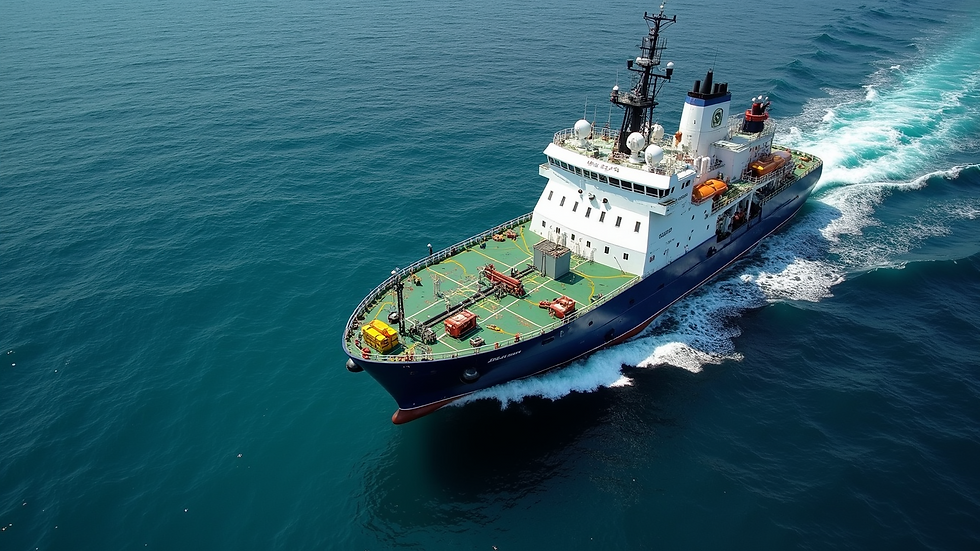
Ocean Infinity's Autonomous Vessels
Ocean Infinity is a company that is revolutionizing ocean mapping with its fleet of autonomous vessels.
Technology: These vessels are equipped with advanced sonar systems and can operate without human intervention. They can cover large areas of the ocean quickly and efficiently.
Applications: Ocean Infinity has been involved in several high-profile mapping projects, including the search for the missing Malaysia Airlines Flight MH370. Their technology allows for detailed mapping of the ocean floor in challenging conditions.
By using autonomous vessels, Ocean Infinity is pushing the boundaries of what is possible in ocean mapping.
The Future of Ocean Mapping and Data Analysis
As technology continues to evolve, the future of ocean mapping and data analysis looks promising.
Emerging Technologies
Several emerging technologies are set to transform ocean mapping further.
Drones: Unmanned aerial vehicles (UAVs) are being used to collect data from the ocean surface. They can monitor water quality, track marine life, and even assist in search and rescue operations.
Artificial Intelligence: AI is being integrated into data analysis processes, allowing for faster and more accurate interpretation of ocean data. This can lead to better decision-making in marine conservation and resource management.
Increased Collaboration
The future of ocean mapping will also see increased collaboration among various stakeholders.
Public-Private Partnerships: Governments, research institutions, and private companies will need to work together to share data and resources. This collaboration will be essential for addressing global challenges such as climate change and marine biodiversity loss.
Citizen Science: Engaging the public in ocean mapping efforts can also enhance data collection. Citizen scientists can contribute valuable information, helping to fill gaps in our understanding of the ocean.
By fostering collaboration, we can create a more comprehensive picture of our oceans and their health.
Embracing the Ocean's Future
The innovations in ocean mapping and data analysis are not just about technology; they are about understanding and protecting our oceans. As we navigate the future, it is crucial to embrace these advancements and use them to foster a sustainable relationship with our marine environments.
By investing in ocean mapping technologies and data analysis, we can unlock the secrets of the deep and ensure that our oceans remain vibrant and healthy for generations to come.

The ocean is a treasure trove of knowledge waiting to be discovered. With the right tools and collaboration, we can chart a course toward a brighter future for our planet's most vital resource.

Comments